Tampilkan postingan dengan label design. Tampilkan semua postingan

Selasa, 01 Juli 2014

A Space that Is Not the Battlefield

  Tidak ada komentar
04.44

by Patrick Sykes


Source: DNA

The dust is settling on Shura City, yet not a single brick has been laid. Since this proposal for a drone-proof city emerged, its creator, Asher Kohn, has attracted the unexpected attention of architects, allies and antagonists alike. I spoke with Asher and Hiba Ali — the visual artist who created a virtual model of the city — as they developed plans for Shura's interior spaces.

The original proposal is a semi-ironic architectural response to drone warfare. It details materials and design features meant to obscure the information that a drone operator uses to identify targets — colored glass to alter skin tones, paneled roofing to cast shadows, and windows coated in QR codes to "act as guard dogs, letting the machines outside know that they are not welcome." The plan draws upon traditional architectural elements found across the Middle East and the Maghreb; badgirs (windcatchers) minimize human heat signatures, and mashrabiyas (projecting windows fronted with intricate latticework) hide Shura's several hundred residents from view.

Fortified cities, of course, are nothing new. The pentagonal walls of Palmanova and the octagonals of Neuf-Brisach are among the most prominent of many historic designs for residential war machines. Yet drone warfare necessitates a different approach. When the asymmetry between parties is so great, the targeted community is unable to simply increase defense in proportion to escalating danger. Shura City is based on the notion that creative use of space may succeed where other forms of intervention fail. Its purpose is to spur debate.

One might argue that any fortified settlement normalizes fear of the world outside. Stephen Graham and Anna Minton, for example, have written about gated communities and their propensity to instill a sense of vulnerability as much as security. Asher contends that fear of drone attacks is already present, and can only be reduced by preventing civilian casualties.

It is essential that security measures do not reduce the quality of life for city residents. "An architectural solution to perpetual defense must bring people out of a siege mentality," Hiba explains. "If the city's exterior is experienced as protective, it should not be a cage, and its interiors should be comfortable, adaptable. This also subconsciously influences how one navigates through private and communal space."

Asher emphasizes the city's open plan, which allows people to "create spaces that work for them." This would include rearranging interior walls and opening roofs. "Giving people the opportunity to make the most of the city, giving them a safe place to create their own city, that was the goal more than creating a utopian city," he says. An open plan may also bypass the authoritarian streak that infuses top-down urban design, setting this project apart from those of "planners who create places that no one actually lives in or enjoys living in." Empowering residents to organize — both politically and architecturally — is one of Shura City's most widely praised features. The word shura means "consultation" in Arabic, representing a form of direct democracy envisioned for the city.

Unlike other fortified cities, Shura isn't equipped for residents to fight back. I asked Asher how he reconciles that with the promise of empowerment. "It puts the aggressor (the human operating the drone) in a position where, knowing that there will be no retaliation, they have to still make the conscious decision to attack," he explains. The city's defensive system involves a similar principle, targeting the drone's ability to process information so that operators must pause and reconsider the potential for unintended consequences.

Given the complex imbalance of drone warfare, a fortified pacifism may be the only hope of effective resistance. From an operator's perspective, Asher concludes, "if someone is a drone target, they must present themselves as a target — 'being with your family' is putting innocence in the crosshairs of a drone, instead of just 'being with your family.' You're never allowed to not be on the battlefield. More than anything else, we're trying to make a space that is not the battlefield."

Patrick Sykes is a writer, editor and radio producer based in Istanbul.

+ share

Read More

Sabtu, 28 September 2013

Tubist Trompe-l'Oeil

  Tidak ada komentar
14.35

by Pierre Nadilon

My first encounter with Tubism was at a house party with a large poster of the London Underground hanging in the living room. Looking closer, I found that the Tube stations had names like Semantics, Leonardo Da Vinci and Fordism. The map was full of intriguing references that served as perfect conversation-starters for the many guests who gathered around it that night.


Harry Beck's design for the London Underground map from 1933. Source: Connections

The poster's designer, Sean O'Mara, encouraged me to try doing my own Tubist posters. It wasn't easy but I began to learn by experimenting with themes like scientific inventions, the Arab-Israeli conflict, LGBT celebrities, songs about Paris, social sciences, poetry and religious rites. Some people asked me to do Tubist portraits based on information from their friends and Facebook profiles.


A Tubist portrait by Pierre Nadilon.

Tubism makes it fun to wander through topics and spot connections. At the same time, it has been criticized for a lack of originality bordering on copyright infringement. I agree that designers who created the original subway maps deserve credit. Tubist imitation is based on respect for the enduring quality of their work. It is also useful for adding an element of surprise: subtly altering well-known images helps bring playful unexpectedness into everyday settings.


"LGBT Pride" version of the San Francisco Muni map, by Pierre Nadilon.

It isn't clear whether Tubism is art, design or something else. Artistically, it draws upon pastiche and trompe-l'oeil. Based on Marcel Duchamp's view of art as the interplay between intent, realization and perception, one might conclude that Tubism is artistic when intended and perceived that way. Simon Patterson's adaptation of the London Underground map, for example, is now part of the Tate collection.


Simon Patterson's famous altered Tube map, "The Great Bear" (1992). Source: Londonist

According to Nelson Goodman, art performs symbolic functions in different contexts, creating aesthetic experiences from specific perspectives. He finds the question "What is art?" less important than "When is art?" Tubists may create aesthetic experiences, but presenting information in unexpected ways is usually a higher priority. In this respect, Tubism is a form of communication design. It is even used for résumés and advertisements, but it is not always so pragmatic.


"Axeland" advertisement by BBH Asia Pacific. Source: Coloribus


"Metro Wine Map of France" by David Gissen. Source: The Atlantic

Despite Tubism's questionable originality and identity, it is a fresh newcomer in the world of street expression. Tubist posters can be attached quickly to walls any time without attracting much attention. In public space, they are akin to understated graffiti or psychogeographic urban interventions. As digital tools for design and printing become more accessible, Tubism could flourish in cities around the world.


"Le Plongeon" version of Line 6 on the Paris Metro, by Pierre Nadilon.

Pierre Nadilon is a digital, conceptual and urban artist based in Paris. He is currently working on a comic with psychological ingredients. Pierre is always willing to share what he knows with people he doesn't know.

Read More

Kamis, 08 Agustus 2013

Secret Gardens of Greater Paris

  Tidak ada komentar
14.07

by Alex Schafran

I imagine that most people, when confronted with the end of a two-year sojourn in the City of Lights, would make plans to visit the unvisited museum (Louvre, check), finally scale the Eiffel Tower (soon, surely), eat the uneaten or discover the exhibition that will change history. The 19th century romantic in me feels pulled to Benjamin's passages and Baudelaire's promenades, even if they're overdone as subjects of literary flânerie. Harvey's Sacre Coeur is part of my daily run, part of life on the Hausmannian edges between the gentrified and the gentrifying.


Parc des Impressionnistes with La Defense in the distance.

Intramuros Paris is still fascinating, still full of impressive and controversial interventions into the urban fabric. The gigantic Rive Gauche project continues to unfold, as does the Batignolles, transforming vast space once dedicated to train infrastructure without sacrificing trains as a mode of transportation. But as Laurent Vermeersch and I have argued on Polis, the banlieues (residential districts beyond the city center) are the main course for any conversation about change in metropolitan Paris and the Île-de-France region.


The Clichy-la-Garenne commune, outside central Paris. Source: Les éditions illimitées

In the comments section of Vermeersch's post, an anonymous reader asks how the banlieues' reputation for monotony survives despite their incredible diversity. The answer is, in part, included in the comment: "True, many people living in the City of Paris don't often set a foot in suburbs, but how many people living in Manhattan, Central London, San Francisco set the foot in the suburbs or in the outer districts of those cities? This is quite normal ... people living in the central area of the city don't go often in the periphery." Normal, yes; conducive to actually knowing anything about your region, no.

So, armed with "L'Indispensable" (my old-school, low-tech guidebook), a streeted-out road bike and a proper camera, I've begun a mad dash around the first three rings of the banlieue. I hope to experience the diversity of this most misunderstood of contemporary urban spaces as it rapidly transforms. The pace of change eludes the navigational powers of my Indispensable (as well as Google and Apple combined); this project seems destined to continue long after I lose my Parisian address.

Extramuros Paris is a bevy of surprising discoveries, a crazy patchwork of historical layerings with micro and macro interventions that make your head spin. All the things you'd expect to find are there — enormous cités (housing projects), freeways, old factories, new office complexes, residential neighborhoods of varying social compositions, malls and outlet stores, single-family homes and reminders that the banlieue is also suburbia. One of my favorite unexpected gems is the parks: not the fact that there are parks, but that there are awesome parks.


A field to rest in can be hard to find in Paris, but not at the Parc des Chanteraines.


Paris (75) and its surrounding departments: Seine et Marne (77), Yvelines (78), Essonne (91), Haut de Seine (92), Seine-Saint-Denis (93), Val de Marne (94) and Val d’Oise (95). Source: GPT

Two of these parks are in the northern transect, which crisscrosses the meandering border between the Hauts-de-Seine (92) and Seine-Saint-Denis (93) banlieue departments. Parc des Impressionnistes, in Hauts-de-Seine, is a bizarre update of Monet's perspective on urban life (the original is still accessible at Parc Monceau). It sounds hokey but it's totally brilliant, with quiet forested nooks, water lilies and big open fields. Wedged between train tracks, factories, neo-Haussmanian apartments, older modernist cités, a sewage treatment plant and various architectural remnants, it boasts a view of both the Sacre Coeur and La Defense, allowing one to contemplate the entire history of the Île-de-France in one sunny afternoon on the grass. Socially, it feels very much like a place between old and new industries and populations, a park that refuses the stereotypes associated with Hauts-de-Seine (bourgeois) and Seine-Saint-Denis (racialized poverty).


Parc des Impressionnistes. Source: Google Earth


Neo-Hausmannian buildings line the Parc des Impressionnistes.

A few miles to the northeast lies the incredible Parc des Chanteraines, a meandering 75 hectares of fields, lakes, bird sanctuaries, pony clubs and prairies. Work on this park began in 1978 and proceeded in stages. From inside, it's hard to believe that you're surrounded by industrial zones. The landscape even cascades across a major freeway, such that you hardly realize what you're doing as you walk to the other side.


Parc des Chanteraines. Source: Google Earth


You are standing on top of a seven-lane highway.

The expansive fields are also an escape from the demographic monotony of the Buttes Chaumont and other leisure spaces of Bobo Paris, where more and more I feel surrounded by people who look like me. Chanteraines boasts a hyper-diverse set of parkgoers seeking respite from the concrete and steel that surrounds it. With the opening of the Saint-Denis/Asnières extension of the T3 tram, this respite is even more accessible from the racialized heart of Saint-Denis. On a sunny afternoon, you get a sense of just how nice this can be.


People of many different backgrounds meet in the Parc des Chanteraines.

Whether or not the transit-led revolution in the Parisian banlieue will be successful is a complex question that will unfold for another half-century, at least. Paris is not simply connecting the periphery to the center, but also taking on the more progressive challenge of connecting the periphery to itself. It certainly helps to have nice places to connect to — places that offer something unavailable inside the walls of the Boulevard Périphérique.

Credits: Photos by Alex Schafran unless otherwise noted in the captions.

+ share

Read More

Jumat, 26 Juli 2013

Community Aesthetics in Heliópolis

  Tidak ada komentar
05.01

by Teresa García Alcaraz

Heliópolis is known as one of the most densely populated neighborhoods in São Paulo, with 120,000 people living in an area of less than one square mile. Legend has it that architect Ruy Ohtake once called it the ugliest part of the city, prompting members of the UNAS community organization to ask him to help make it beautiful.


Heliópolis. Source: Roberto Rocco

To their surprise, Ohtake agreed and began working with residents to transform the ubiquitous brick and concrete walls into a vibrant cityscape. Together they decided on a flexible color scheme to use in painting the neighborhood. Ohtake selected the trim for windows and doors to subtly unite the composition.


Streets in Heliópolis before (above) and after (below). Source: Daniela Schneider

Painting didn't begin until each participant was happy with his or her choice. In the meantime, Ohtake found a local company to donate supplies. When everyone was ready they painted the buildings together.


Ohtake found that participants acquired a "civic sense not by any concept handed to them by an architect, but by action, from results they achieved while making their own environment more beautiful."

This project may seem like another celebrated attempt by an outside expert to address a situation that needs more than surface treatment. Still, it prompted residents to get to know each other and work together. At least as important as the results, collaborative planning and execution generated a sense of community around a shared purpose.

+ share

Read More

Rabu, 17 Juli 2013

Reversing the Panopticon

  Tidak ada komentar
06.17

by Dieter Zinnbauer

The infamous Panopticon, conceived by Jeremy Bentham and thoroughly analyzed by Michel Foucault, is emblematic of architecture's role in surveillance and discipline — a blueprint for the perfect prison. It allows a watchman to observe inmates without them being able to tell whether anyone is actually watching them, generating an eerie sense of being monitored all the time.


Panopticons by Jay Crum. Source: Celeste

Bentham's Panopticon blazed a trail for many technological interventions designed to help governments monitor and control public space. Check out Skywatch, for example, the mobile observation structure used to keep an eye on the Occupy Movement in New York City. This high-tech platform — equipped with sensors, cameras and tinted windows — is also used at crime hot-spots.


Greenpeace Twitter wall. Source: Transparency International

Anti-corruption NGOs, such as Transparency International (where I work), help people monitor and control what their governments do. In essence, this is about reversing the Panopticon. Tactics include establishing openness and accountability policies, mobilizing civic action and raising awareness. Returning to the spatial aspect of the Panopticon, important questions arise: Can we shape the built environment in a systematic way to empower citizens vis-à-vis their governments? Can we literally design for transparency and accountability?


Albert Sirleaf's public bulletin board in Monrovia. Source: Ambient Accountability

The term "ambient accountability" refers to creative adaptation of the built environment for the purpose of citizen empowerment, as explained with examples in "'Ambient Accountability': Fighting Corruption When and Where it Happens." To encourage dialogue on this subject, I've started collecting related information, ideas and images — including the public bulletin board above — in a blog about Ambient Accountability. I welcome everyone to add to the collection.


"Panopticon, Isla de Pinos" by Stan Douglass. Source: National Gallery of Canada

So how can we turn the Panopticon around? Contrast the classic Panopticon, a prison tower (above), with the bright red Infobox (below). The Infobox was a viewing platform set up in 1995 so that people could observe a massive public-private redevelopment venture in Berlin.


The Infobox public viewing platform at Potsdamer Platz in Berlin. Source: archINFORM

The Infobox made it easier for citizens to track the progress of significant changes in their city — a largely symbolic gesture for public relations, but at least a step toward publicly monitoring the work of public officials and private developers.

What other design interventions could help turn the Panopticon around? Can we adapt the built environment for democracy and accountability? I would love to hear your thoughts and ideas.

Dieter Zinnbauer is a specialist in policy and innovation for Transparency International. More of his work can be found on the Social Science Research Network and Ambient Accountability websites.

+ share

Read More

Sabtu, 06 Juli 2013

Informality and Injustice in the Resilient City

  Tidak ada komentar
06.47

by Andrew Wade


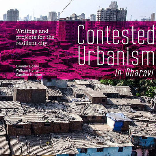
William Hunter is an architect, urban designer and teaching fellow at The Bartlett Development Planning Unit (DPU), University College London. I recently caught up with him to discuss his new book, "Contested Urbanism in Dharavi: Writings and Projects for the Resilient City," a collaboration with Camillo Boano and Caroline Newton. Dharavi — perhaps the most famous informal settlement in the world — has featured on Polis many times and we're excited to return via William's experience.

How did this project come about?

The book is a culmination of work dating back to May of 2009, when a group of students from the DPU's Building and Urban Design in Development program travelled to Mumbai for a three-week research trip. Professor Camillo Boano led the project in collaboration with SPARC, an Indian NGO focused on housing and infrastructure for the urban poor. I was a student in the course, and for most of us it was the first time we'd encountered such extreme informality — from the harsh living conditions to the flourishing economic activity and political activism. This was an arena in which conflicting processes of empowerment and exploitation make comprehensive transformation seem unattainable.

Grappling with what we found in Dharavi from practical and theoretical points of view, we arrived at a studio module for the next three years. The attention and collective effort given during this time warranted proper documentation — compiling the group's research, reflections and project work into a single volume. Former students, DPU staff and many others helped us prepare the book for publication.


Why Dharavi?

There seemed to be thousands of microscopes pointed at this plot of land in central Mumbai with the powerful, if unsubstantiated, epithet "Asia's largest slum." Dharavi was at the tip of everyone's tongue — in academia, in the media, in works of non-fiction and fiction, even in cinema. Release of the movie "Slumdog Millionaire" earlier that year created a somewhat glamorized image of slum living that seemed worth interrogating. Our involvement was part of this wave of intrigue, but with a challenging objective.

The DPU had established longstanding relationships with SPARC, Homeless International and Slum-Dwellers International (SDI) as well as their national affiliate, the National Slum-Dwellers Federation (NSDF). We knew that we weren't the first student group to land in Dharavi, though we felt at the time — and still do — that we were approaching the situation differently from the way others had. We shared an affinity for the architecturally driven projects by groups from Columbia University and TU Berlin, but were focused more on studying the roots of social problems and the experience of local communities. We wanted to understand the power relations at play in "slum upgrading" plans in order to inform a participatory design process.


What did your group focus on?

What's interesting is that Dharavi isn't even Mumbai's largest slum, let alone Asia's. The peri-urban Mankhurd-Govandi and Dindoshi settlements, for example, have eclipsed Dharavi in size and estimated population. But because of Dharavi's prime location at a potential transit hub just south of the Bandra Kurla Business Complex, it's caught up in conflict over Mumbai's future development.

The Dharavi Redevelopment Project (DRP), a scheme proposed and managed by architect-consultant Mukesh Mehta following a report produced by McKinsey and Company in 2003, aimed to establish a foundation for transforming Mumbai into a "world-class city" free of informal settlements. Hypothetically, this would be a great thing; living conditions are dire, with an alarming lack of basic services. But the DRP involved suspect means of implementation: among the approximately 40,000 square feet of private residential and commercial space, each Dharavi household would receive only 270 square feet of resettlement housing, and only those who could prove that they'd lived in the settlement prior to the year 2000. The project threatened places of residence and employment. Its profit-driven approach placed residents on the defensive, rendering Dharavi a perfect storm of contested urbanism.


Would you say that contested urbanism is a new global phenomenon?

It's not a new phenomenon, but definitely global. The Occupy Movement is a viral example. It involves conflicts over local space that extend to conflicts over governing the commons at other scales, over access to local and global resources. Urbanism also involves reading and investigating a place. While it seems like a familiar idea, we attempted a more critical interpretation through the notion of contested urbanism. We wanted to unpack the many different and at times contradictory power relations at play in Dharavi. We were also thinking about how similar processes take place in other settings around the world, and how to confront them in theory and practice.


How did you confront these instances of local and global spatial conflict?

We examined relationships between space, politics and society. Our approach is rooted in Lefebvre's "production of space," Heidegger's "human spatiality" and Foucault's assertion that "space is fundamental in any exercise of power." We also drew upon Lefebvre's "right to the city" and the "critical regionalism" of Alexander Tzonis and Liane Lefaivre. These concepts shed light on conflicts between people and top-down control over urban development.

The inner conflicts of development practitioners required attention as well. When we visited Dharavi and began writing about it as a studio case study, a focus on contested urbanism helped us escape the tendency to think mainly in terms of design solutions. It served as an alternative way of thinking, of enriching the possibilities for critically assessing and acting within a highly complex urban setting.


Resilience comes up often in urban planning and design, often without much critical reflection. What role did it play in your project?

In the face of struggle for equality in the city, and certainly in the wake of natural and manmade disasters, the idea of resilience is very important. The ability of individuals and communities to address immense challenges is based on unwavering effort. We see this all over the world: in southern Louisiana — where I grew up — following Hurricane Katrina, in the massive rebuilding underway in Haiti. The list goes on and on. But the everyday resilience in Dharavi is unmatched in terms of DIY building and economic activity.

Almost everything in Dharavi is part of an informal process, from the sanitation systems to the electrical grids. There is a profound coping mechanism on display, with people adjusting to a severe lack of services and a precarious future. Yet Dharavi's streets are as vibrant and bustling as those of any "global city." You can find almost anything in its markets and much of the goods are actually produced locally. I remember an article in the Economist that estimated the value of annual production in Dharavi at $500 million, and much of it is sold outside the settlement. This activity in the midst of such unhealthy and unjust living conditions is evidence of profound resilience.


What is in store for Dharavi, and what implications might this have for addressing urban poverty worldwide?

In Dharavi, the latest news is that the DRP has been momentarily thwarted by grassroots opposition. The Indian Alliance (SPARC, NSDF and Mahila Milan) and the Special Advisory Committee of Experts appointed to "humanize" the DRP have contributed substantially to this effort. It is a great achievement, calling attention to the need for revising policies like the Slum Rehabilitation Act, which places unfair limits on eligibility for resettlement housing.

A parallel issue is recognition, which has always been an obstacle in Dharavi and other informal settlements. The government just doesn't know how many people live in these areas, as surveys quickly become outdated with the constant flow of urbanization. Securing accurate population data is a positive step toward upgrading infrastructure, housing and services.


Informal settlements place unique demands on mainstream planning. Their strengths and weaknesses have to be taken into account when approaching redevelopment. Projects like Homegrown Cities can help by supporting local solutions to housing development and preserving resident livelihoods.

Engagement with contested urbanism requires critical, inclusive and locally specific problem-solving. People will continue to overcome obstacles and outperform expectations. This is evident in Dharavi and in so many other settlements around the world. Informal resilience and DIY ingenuity show that cities can be built and governed from below. At the same time, slum residents require and deserve the same level of services that other members of society receive.

Advance copies of "Contested Urbanism in Dharavi: Writings and Projects for the Resilient City" can be purchased by sending an email to dpu@ucl.ac.uk.

Credits: Photos by William Hunter.

+ share

Read More